Informal Paths
-
Hi,
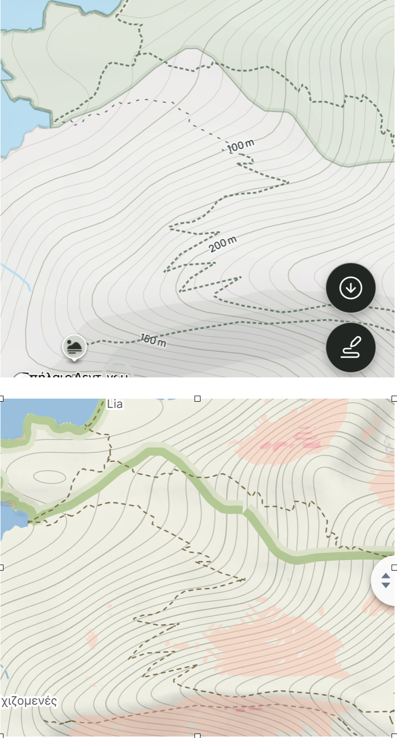
I've been mapping the island I live on, Syros on openstreetmap.org (user:steadivision). I've noticed that some map programs distinguish between regular and informal paths, as in the top screenshot. Look at the trail to the north of the zig-zag. The bottom one from Mapy does not distinguish. I'd like to recommend Mapy to my guests, but I don't want them to think they are lost when they are actually on an unmarked trail. Is it possible that you can display these paths differently?
Thanks!
Chris
-
Hello,
thank you for your message and for your work on OpenStreetMap!
At the moment, Mapy.com distinguishes mainly between forest/field tracks and footpaths, including difficult mountain footpaths in exposed terrain. We currently do not have a separate visual style for informal or unmarked paths, so these may appear the same as other footpaths.
Thank you for the suggestion — we’ll note it as a possible improvement for the future:)
Hello! It looks like you're interested in this conversation, but you don't have an account yet.
Getting fed up of having to scroll through the same posts each visit? When you register for an account, you'll always come back to exactly where you were before, and choose to be notified of new replies (either via email, or push notification). You'll also be able to save bookmarks and upvote posts to show your appreciation to other community members.
With your input, this post could be even better 💗
Register Login