Displaying the road gradient (incline/decline)
-
Hello Mapy.cz Team,
First of all, thank you for the excellent cycling-route planner you’ve built. I use it regularly and really appreciate the clarity and ease of use.
I’d like to suggest a new feature for the bike-route generator: displaying the road gradient (incline/decline) directly on the generated map—similar to what Strava offers. Showing the percentage grade along each segment would help cyclists:
- Better anticipate steep climbs or descents
- Plan their effort and pacing more effectively
- Choose routes that match their fitness and preferences
Including gradient data alongside distance and elevation gain would make Mapy.cz an even more valuable tool for cyclists of every level.
Thank you for considering this enhancement. I’d be happy to clarify any details or help test the feature.
Best regards,
Daniel Sandor
-
@Daniel-Sandor Hi, when you're planning a route, you can see the elevation profile by tapping on route details. Is this what you're looking for, or would you like to add another feature? Link to help about route planning.
-
Hello @Ewelina
Thanks so much for your answer. I am not referring to the elevation gain, that feature is also important, but I am talking about the GRADE of elevation along the way, to be able to understand the inclination or declination of the road.
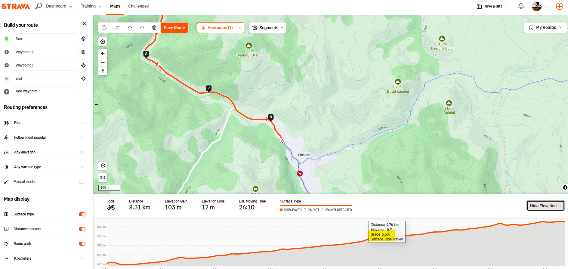
If you check the image attached, you will understand better. After generating the map, there should be the possibility to check also the inclination on those segments which are more difficult to climb.Regards,
Hello! It looks like you're interested in this conversation, but you don't have an account yet.
Getting fed up of having to scroll through the same posts each visit? When you register for an account, you'll always come back to exactly where you were before, and choose to be notified of new replies (either via email, or push notification). You'll also be able to save bookmarks and upvote posts to show your appreciation to other community members.
With your input, this post could be even better 💗
Register Login